services
Remote Sensing/LiDAR
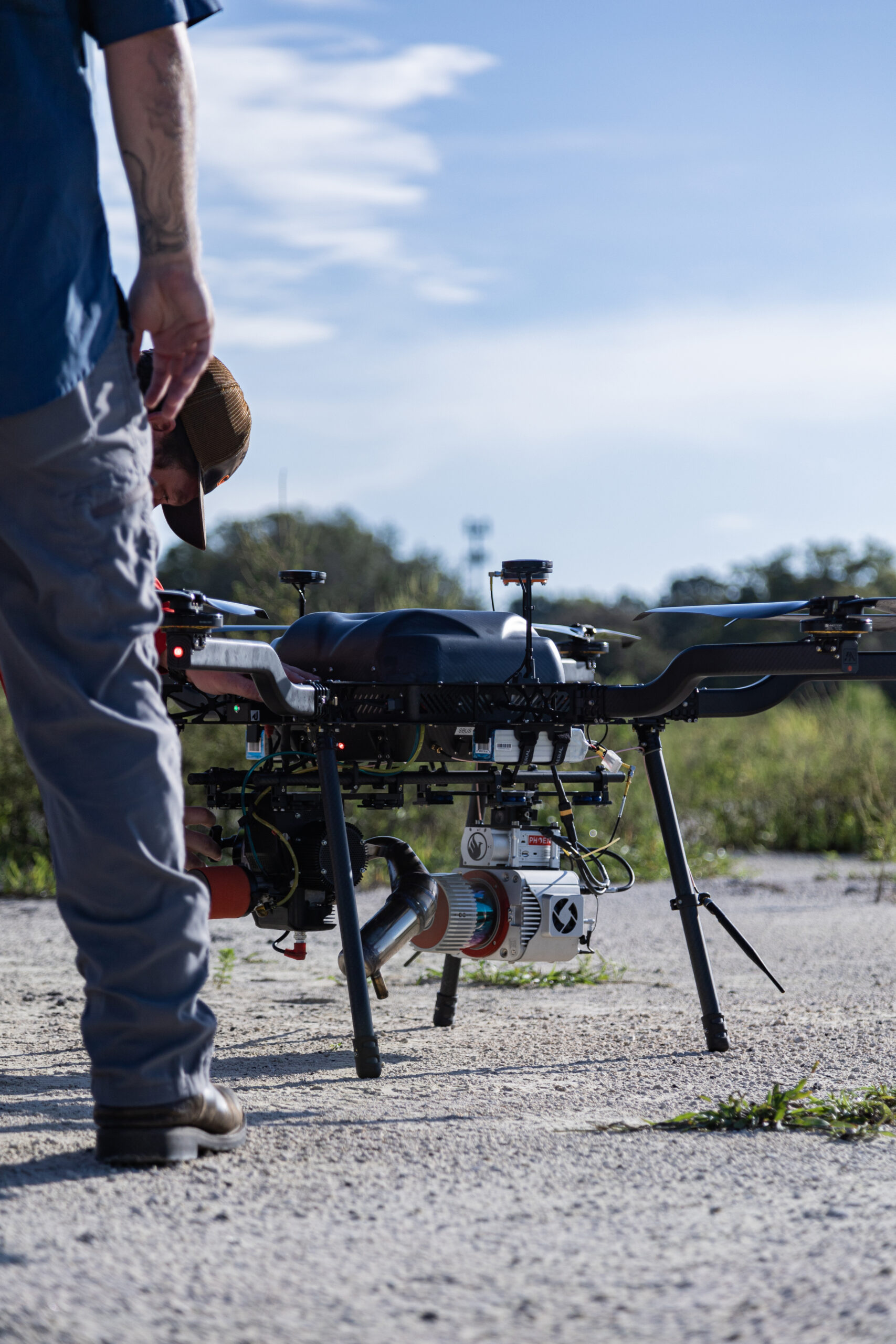
Just when we thought surveying couldn’t get any cooler, we posted job openings for “pilots” to perform remote sensing LiDAR surveys.
And with a cadre of the latest technology in UAS photogrammetry, top of the line long range, high-definition Remote Sensing/LiDAR scanning systems and industry standard software, our team of FAA certified pilots has developed our remote sensing LiDAR services department into a leader in our industry. No matter the topography or obstacles on the ground, our advanced hyperspectral imaging systems will deliver quick-turn around, high resolution scans with attention to clarity and accuracy that are on point.
- High Definition Aerial Mapping
- Small and Large Area Mapping Capabilities
- Calibrated Point Clouds
- FAA Certified Pilots
- LiDAR Scanning Systems
- Static & Kinematic Sensors
- Advanced Processing Methods
- Aerial Route Exhibits and Details
on point
Remote Sensing/LiDAR
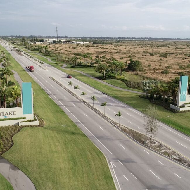
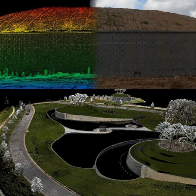
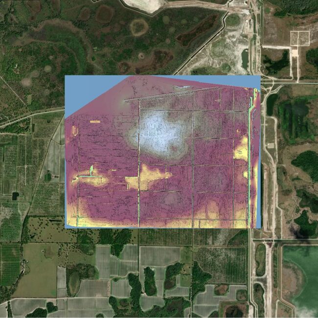
Remote sensing is at the leading edge of services provided by GeoPoint Surveying. For that reason, we approach it with the same vigor and commitment to quality as our other surveys. The recent adaptation of unmanned aerial systems has brought unprecedented growth to many fields. So, GeoPoint has established itself as a leader in the implementation of these technologies for use in our long-established surveying practices.
We have a team of FAA Certified Pilots. We use the latest technology in UAS photogrammetry, top of the line Remote Sensing/LiDAR scanning systems and industry standard software. As a result, we capture up to the minute aerial imagery in high definition. These images augment our surveys that are already known for their clarity and accuracy. We also scan properties using advanced hyperspectral imaging systems to create surfaces and model terrain in high resolution using billions of data points. No matter the project, the advantages of flights unencumbered by obstacles on the ground and utilization of advanced processing methods, allows us to complete your project in a fraction of the time.