OUR EXPERIENCE COVERS A BROAD RANGE OF FLORIDA LAND SURVEYING PROJECTS, INCLUDING RESIDENTIAL, COMMERCIAL, INDUSTRIAL, INSTITUTIONAL, ENERGY, TRANSPORTATION, AND VARIOUS OTHER PUBLIC AND PRIVATE PROJECTS.
What We Do
Land Development Services
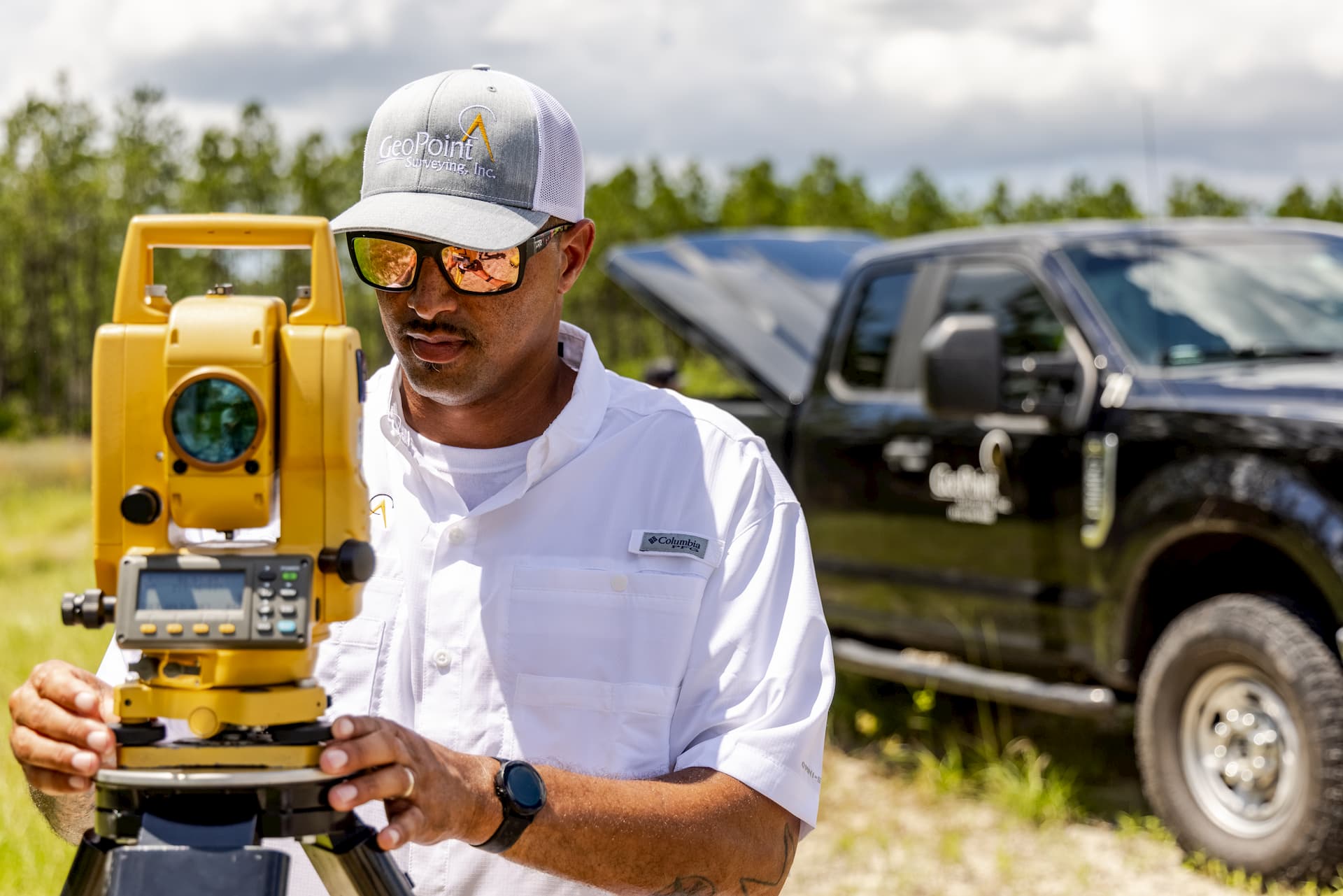
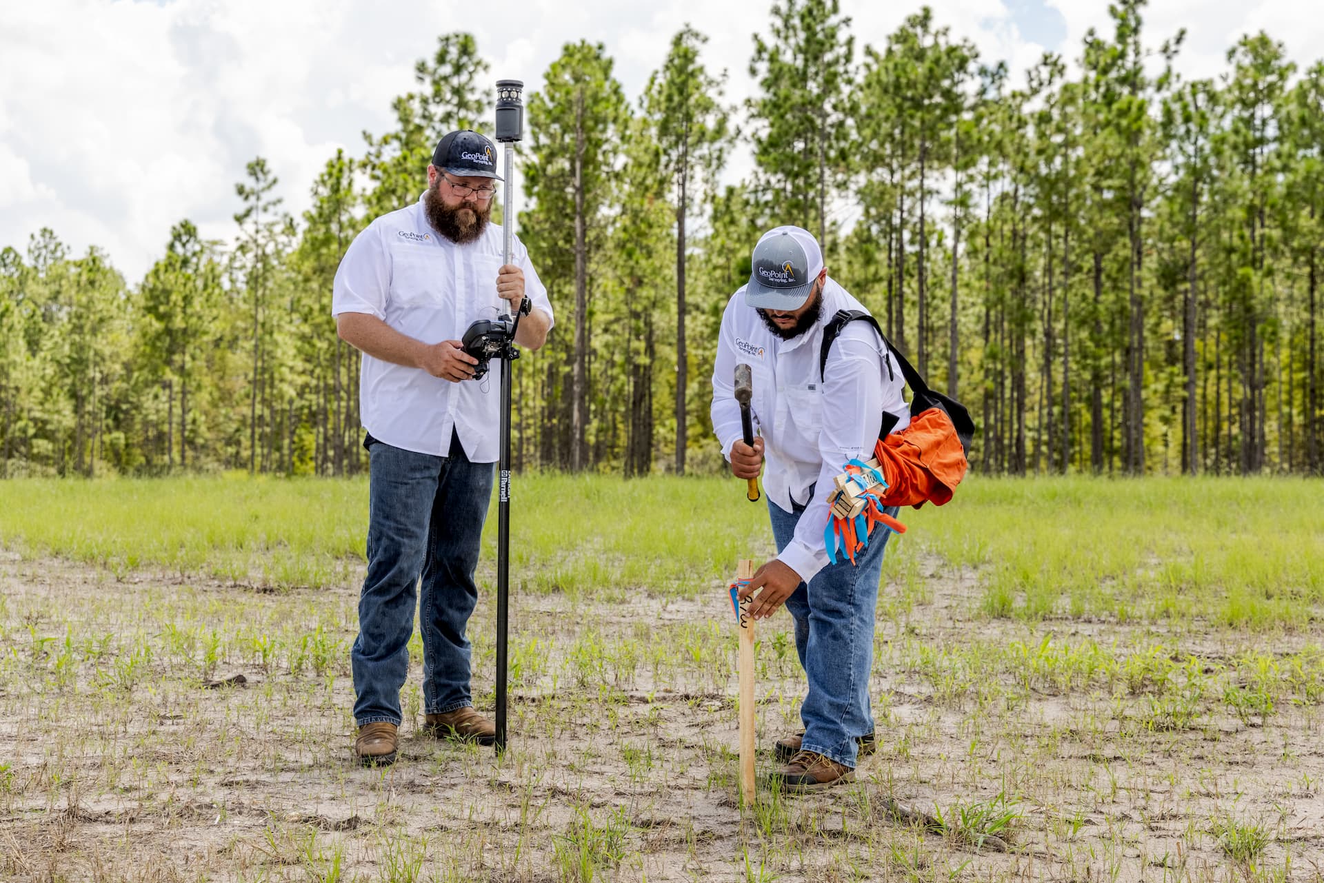
Commercial and residential land development is the cornerstone of our business and our performance is on point. In fact, we love getting in the dirt and helping raise up the next building, community, or point of interest. With leading-edge technology, and specialized crews, we’ll exceed your expectations at every level of land development from boundary surveys, to platting and construction staking.
What We Do
Construction Support Services
With the engineer or architect’s plan in hand, we hit the ground running. We utilize the best technology and equipment to stake out the position of roads, utilities, drainage, buildings, and other land development plans. Our highly specialized crews are on point and continue to raise the standard of service when called upon. Therefore we deliver on project deadlines, exceed expectations and meet the demands of a fast-paced industry.
What We Do
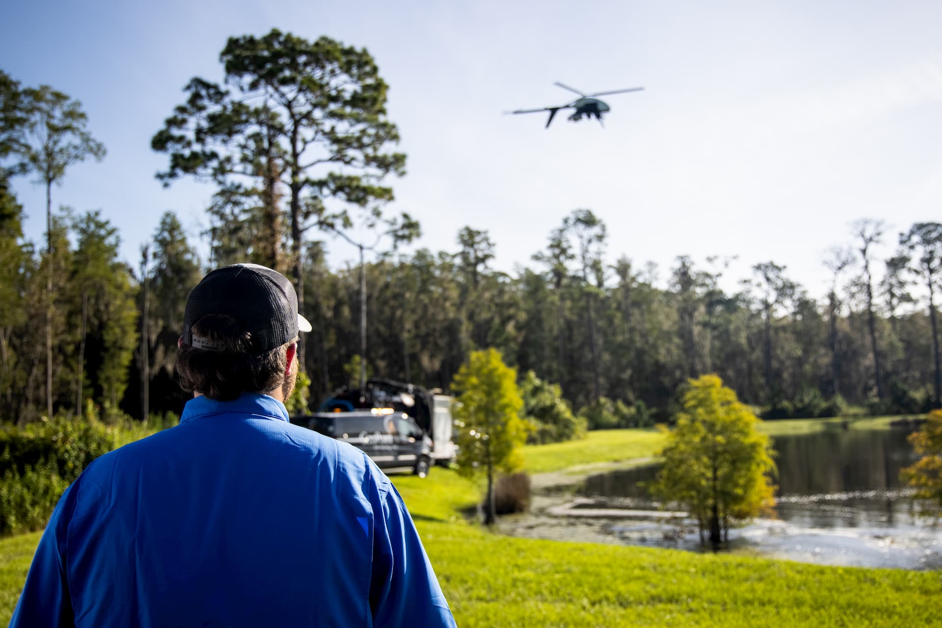
Remote Sensing/LiDAR
Just when we thought surveying couldn’t get any cooler, we posted job openings for “pilots.” Altogether, with a cadre of the latest technology in UAS photogrammetry, top of the line LiDAR scanning systems and industry standard software, our team of FAA certified pilots developed our remote sensing services department into a leader in our industry. No matter the topography or obstacles on the ground, our advanced hyperspectral imaging systems will deliver high resolution scans quickly, with clarity and accuracy that are on point.
What We Do
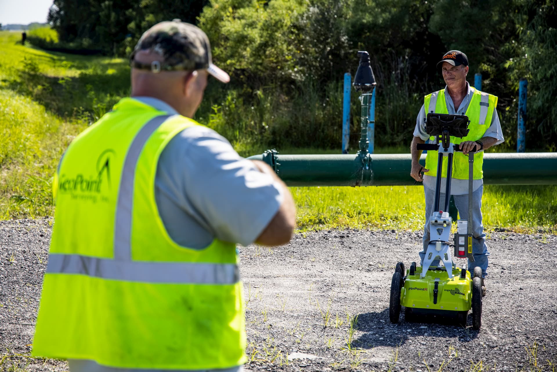
Subsurface Utility Engineering
Knowing what’s below is essential to every land development or improvement, and we’ve invested in a forward-thinking subsurface utility exploration team with a full toolbox of technology and capabilities to make us the best in our field. Whether we’re using air and hydro vacuum excavating, electromagnetic locating, ground penetrating radar, asset mapping or foundation/structure clearing, you can be certain that the project you’re about to build out is on point.
What We Do
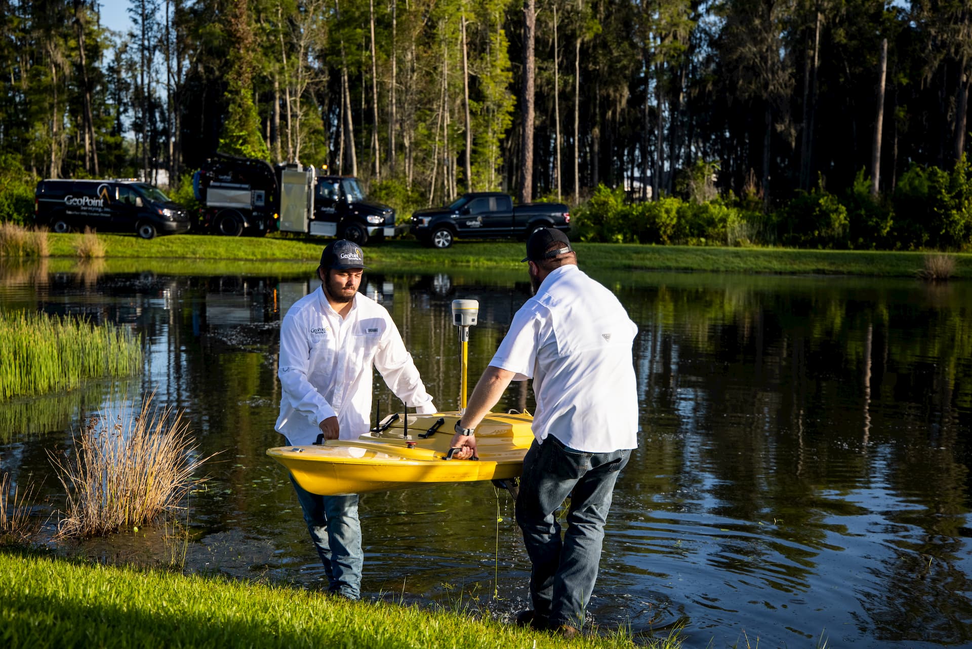
Hydrographic Surveys
While most survey companies stick with dry land, we’ve never been afraid of getting a little wet. Our hydrographic survey crews are experts at providing cross sections, spot elevations and seamless topographic models. We utilize specialized remote sensing sonar technologies in everything from residential retaining ponds to the open ocean. Our customized hydrographic deliverables are the missing piece to get your next project on point.
What We Do
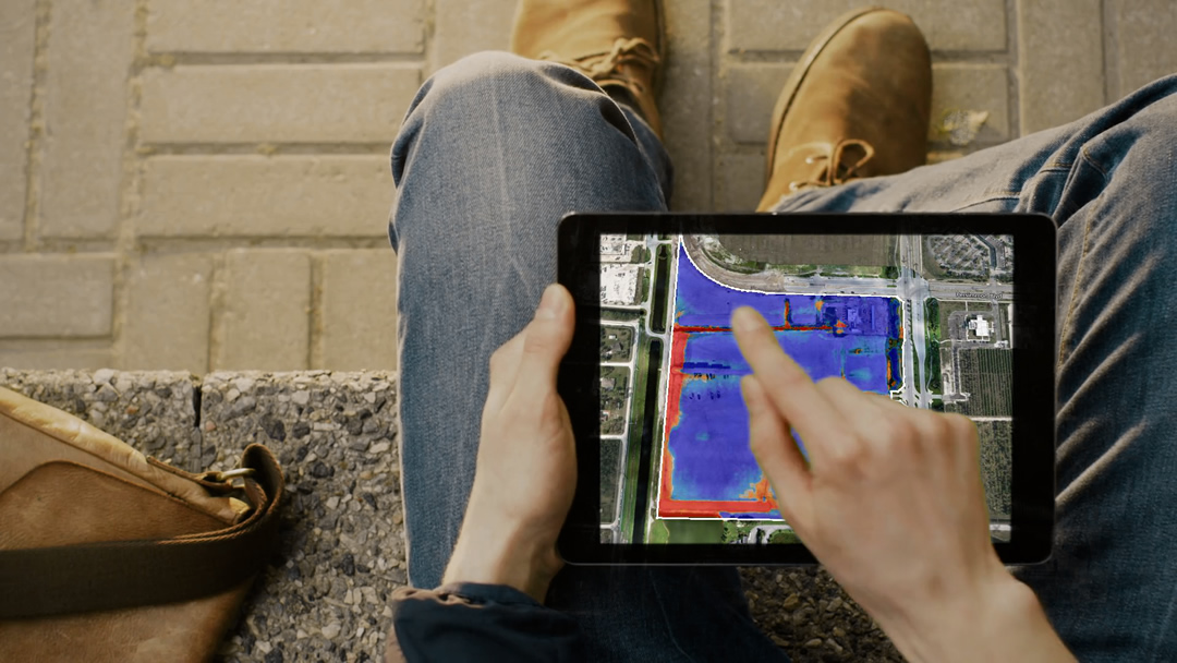
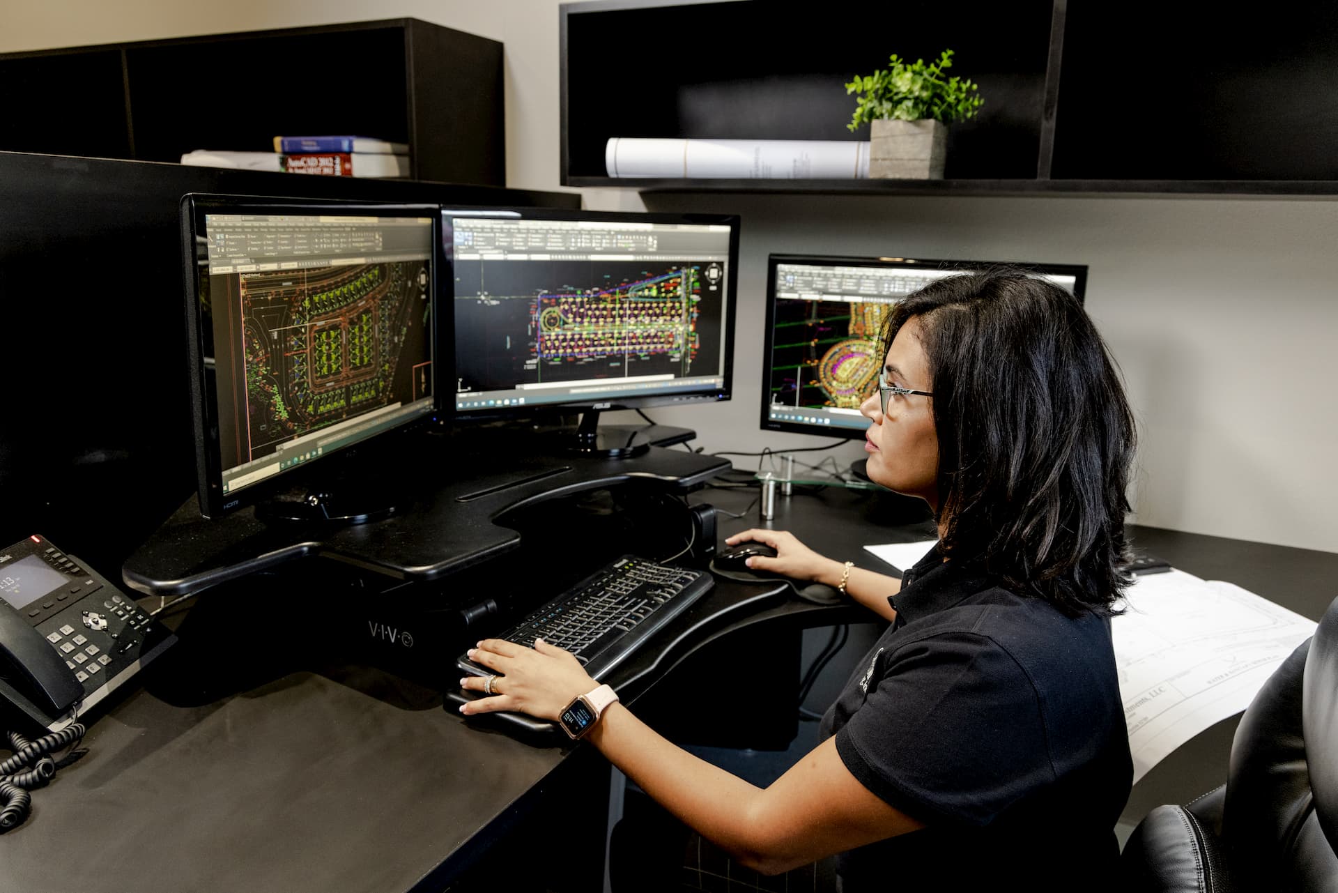
Geographic Information Systems
Once we’ve shaken the dirt off our boots, we’re back in the office helping you optimize your project by using Geographic Information System (G.I.S.) to manage and analyze the data collected by our leading-edge technology and crews of skilled technicians. Our clients use the delivered G.I.S. assets to reduce capital costs, provide clarity and advanced visualization tools for meetings, ensure proper risk management and finally get their land development project on point.
What We Do
Geographical Visualization & Interactive Services
To meet the demands of rapid-pace land development projects, our crews survey and process large land areas quickly and precisely. So, we create 3D interactive maps that are accessed remotely and used to measure and manage job sites. These Geographical Visualization and Interactive Services (GeoVIS) include certified, survey-grade assets that can be ordered as a one-time deliverable specifically for purposes of project scale measurement, budget and cost calculations, or as a subscription. Subscriptions allow for continual oversight and management for the duration of a project timeline.