services
Subsurface Utility Engineering
Subsurface utility engineering is the first step to knowing what’s below and it’s essential to every land improvement.
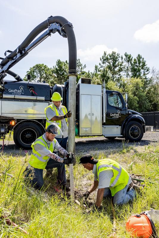
With forward-thinking wireless remote capabilities and acute visual technology to monitor excavation progress, GeoPoint Surveying sets the standard in subsurface utility engineering and subsurface utility locating. We utilize VACTOR® HXX ParaDIGm® vacuum excavators — the subsurface utility engineering industry’s premier powerhouse equipment — to provide precision air or hydro excavations and the most efficient view of underground infrastructure. The unit’s compact design allows the truck access in tight urban areas and its quick set-up enables our technicians to achieve the highest “park and dig” productivity on the market.
- Utility Records Research & Analysis
- Surface & Subsurface Utility Coordination
- Underground Utility Exposure
- Utility Design Plans & Consulting
- GIS Utility Web Applications
- Utility Location & Evaluations
- Advanced Visualization Techniques
Setting the standard
What We Do Underground

AIR/HYDRO VACUUM EXCAVATING
Our non-destructive air and hydro vacuum methods achieve three-dimensional location mapping of any underground utility, pipe, or line. Vacuum excavation is also used for foundation and structure clearing.

ELECTROMAGNETIC LOCATING
By introducing different frequencies onto metallic pipes or cables using a transmitter, a receiver can hone in on the utilities’ horizontal locations.

GROUND PENETRATING RADAR
This non-evasive locating method uses radio waves to detect both metallic and non-metallic utility infrastructure. GPR can also detect buried tanks or structures.

ASSET MAPPING
After mapping existing utilities with electromagnetic locators, we leverage GPR and GPS technology to create interactive utility databases.

CONCRETE SCANNING
This non-evasive locating method uses higher frequencies to detect utilities, rebar, and post-tension cables in concrete slabs and columns.

UNDERGROUND UTILITY LOCATING
Our utility locating services include turn-key ticket management and damage prevention solutions per Sunshine 811 Chapter 556 for utility owners. Private utility locating is also available.
on point
Underground Utility Locating
The inability to obtain dependable underground utility information has been an issue since the first utility lines were implemented. GeoPoint Surveying provides high quality Subsurface Utility Engineering (S.U.E.) data tailored to our client’s needs. We use a combination of Florida land survey mapping, ground penetrating radar, electromagnetic sensors and excavation technologies.
Our team adheres with the ASCE-38-22 standard for the Collection and Depiction of Existing Subsurface Utility Data for all four quality levels (A,B,C,D). Our work entails Route projects, large scale commercial projects, athletic facilities and more. We work with our clients to develop the best approach for each project in order to confirm or resolve any subsurface utility issues you may have.


