services
Geographical Visualization Interactive Services
Keep track of your job site progress with GeoVIS. Our precise, remote-access interactive mapping solution.
To meet the demands of rapid-pace land development projects, our skilled crews survey and process large land areas quickly and precisely, creating 3D interactive maps that are accessed remotely and used to measure and manage job sites. These Geographical Visualization Interactive Services include certified, survey-grade assets that can be ordered as a one-time deliverable for purposes of project scale measurement, budget and cost calculations, or as a subscription, allowing for continual oversight and management for the duration of a project timeline. GeoVIS assets reduce capital costs, provide clarity and advanced visualization tools for meetings, and ensure proper risk and quality control management.
- Ideal for large-scale projects
- Remote client dashboard offers 24/7 access
- Review and compare job site status against plan sets using interactive tools
- Measure and report construction progress
- Calculate and verify earthworks projects
- QA/QC remotely without stepping foot on the job site
- Verify need-to-pay applications
- Mobile app with real-time communication for on-site service
on point
Geographical Visualization Interactive Services
Our GeoVIS subscription service is the newest offering in GeoPoint Surveying’s toolbox of leading-edge technology and equipment. With a cadre of the latest technology in UAS photogrammetry, our team of FAA certified pilots capture and deliver quick-turn around, high resolution scans with clarity and accuracy that are on point. And now, with 24/7 remote access to mapping assets, our clients experience the value of GeoVIS that has made us a leader in our industry.
Our expert GeoVIS crews and analysts are experienced and trained in a multitude of project categories, enabling Geographical Visualization Interactive Services (GeoVIS) to a wide range of clients and a variety of project scales.
on point
Map, Measure & Manage in 3D with GeoVIS
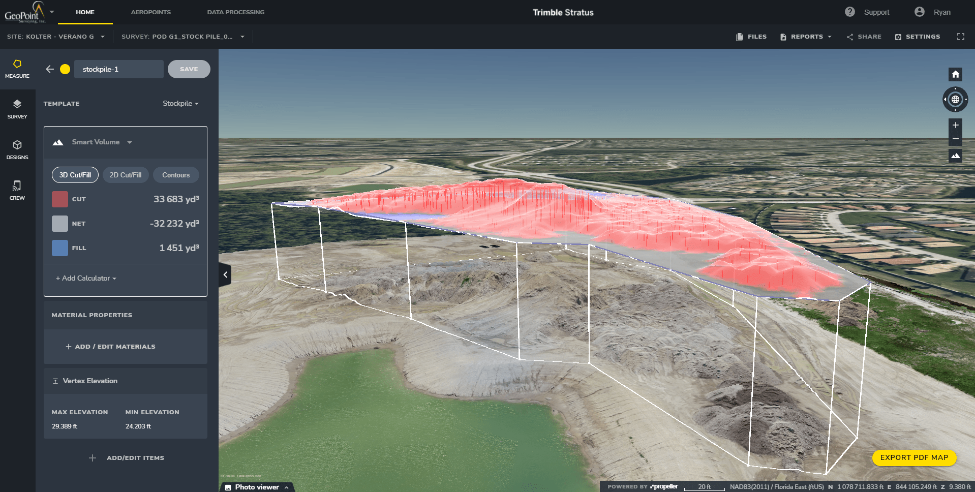
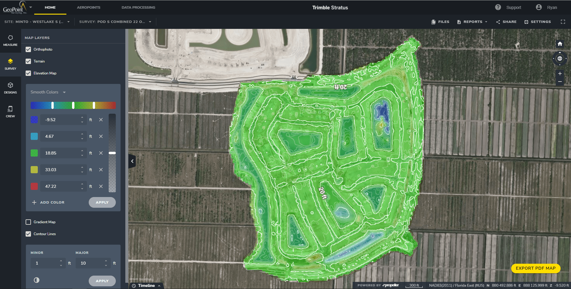
Using Trimble® Stratus powered by Propeller, GeoVis offers a variety of interactive tools to map, measure and compare current site conditions against plan sets, project and site management is streamlined with accuracy to a 10th of a foot. With Geographical Visualization data, Quality control, quality assurance, and verification for need-to-pay applications has never been more simple or precise.


on point
GeoVIS Remote & Mobile Technology
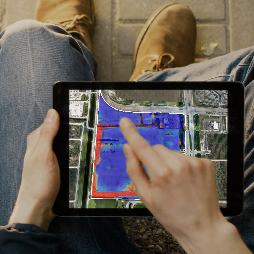
Manage your job sites quickly and efficiently with remote access to your GeoVIS assets, allowing for up-to-date status no matter your location. Plus, use our mobile app, CREW, to complement on-site walk-throughs, record job site notes, share Geographical Visualization data info with stakeholders, and request service from GeoPoint with real-time communication.
on point
GeoVIS Data Optimized for Earthworks & Plan Set Data
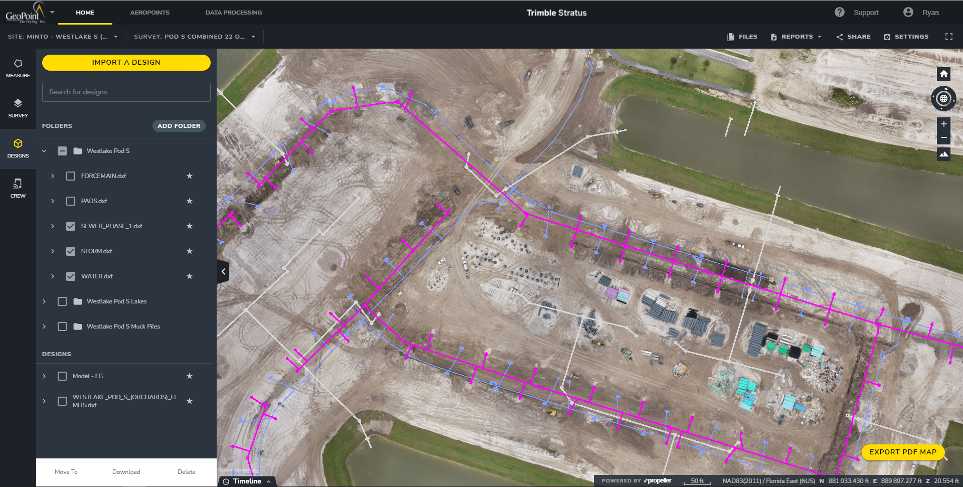
From pre-bid through completion, utilize the GeoVIS service to compare project status using regularly updated data from frequent drone flights for precise accuracy. Maintain oversight of plan set features, such as sanitary, sewer and water services, transformer pad locations, drainage line work, fill and extraction levels and more. Spot problems using Geographical Visualization Interactive Services (GeoVIS) before they become obstacles and costly to rework.


